Estimating Lively Streets
This project aims to estimate how ‘lively’ streets are. It provides a method that connects amenities (including public transportation hubs) with the closest nodes in the street network, calculates the shortest paths between each pair of amenities, and counts on how many shortest paths that are shorter than a given walking distance between amenities each street segments within the given area lies.
Architects try to design vivid streets and public squares, and their renderings and visualisation of public spaces are often full of people. Wether these designs will lead to lively streets or not seems very hard to quantify: Streets and public spaces exist in all shapes and forms, with different buildings and geometry, in different cultures in different climates.
Architects try to design vivid streets and public squares, and their renderings and visualisation of public spaces are often full of people. Wether these designs will lead to lively streets or not seems very hard to quantify: Streets and public spaces exist in all shapes and forms, with different buildings and geometry, in different cultures in different climates.
Trying to understand the city as a multitude of overlaying networks, it seems that the precise shape of buildings etc. might be less important than how locations interact with each other, how people interact with locations, how people interact with people and so on. Public spaces rely on the people passing by randomly. Thus this method is a simple combination of three things:
1. What people walk on - the morphology of the street network on a local level
2. How it is connected to the things in the city people want to go to - The city’s amenities, and
3. How people use it in order to get there - the route planning.
1. What people walk on - the morphology of the street network on a local level
2. How it is connected to the things in the city people want to go to - The city’s amenities, and
3. How people use it in order to get there - the route planning.
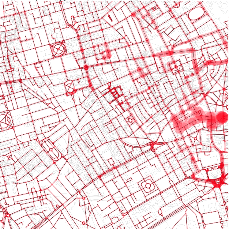
Central London (Euston / Holborn)
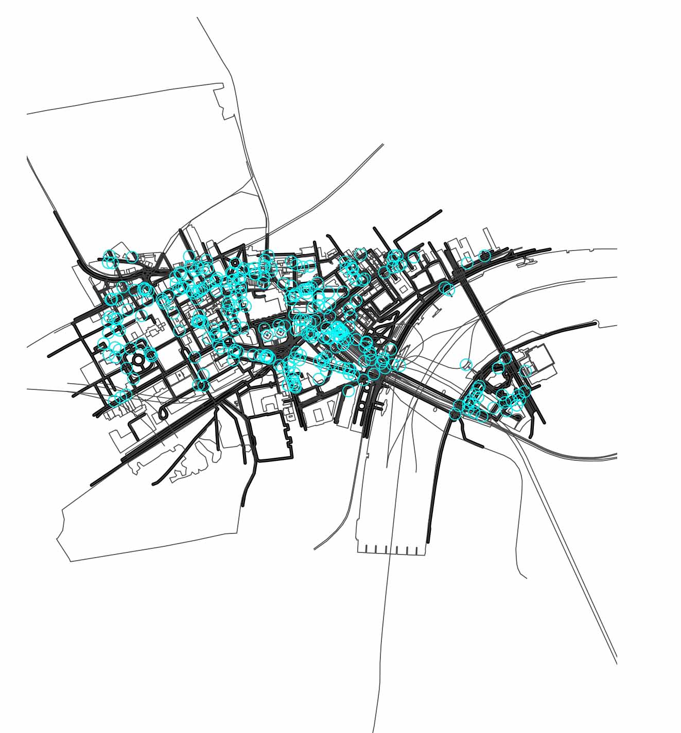
Data input: Street network and amenities
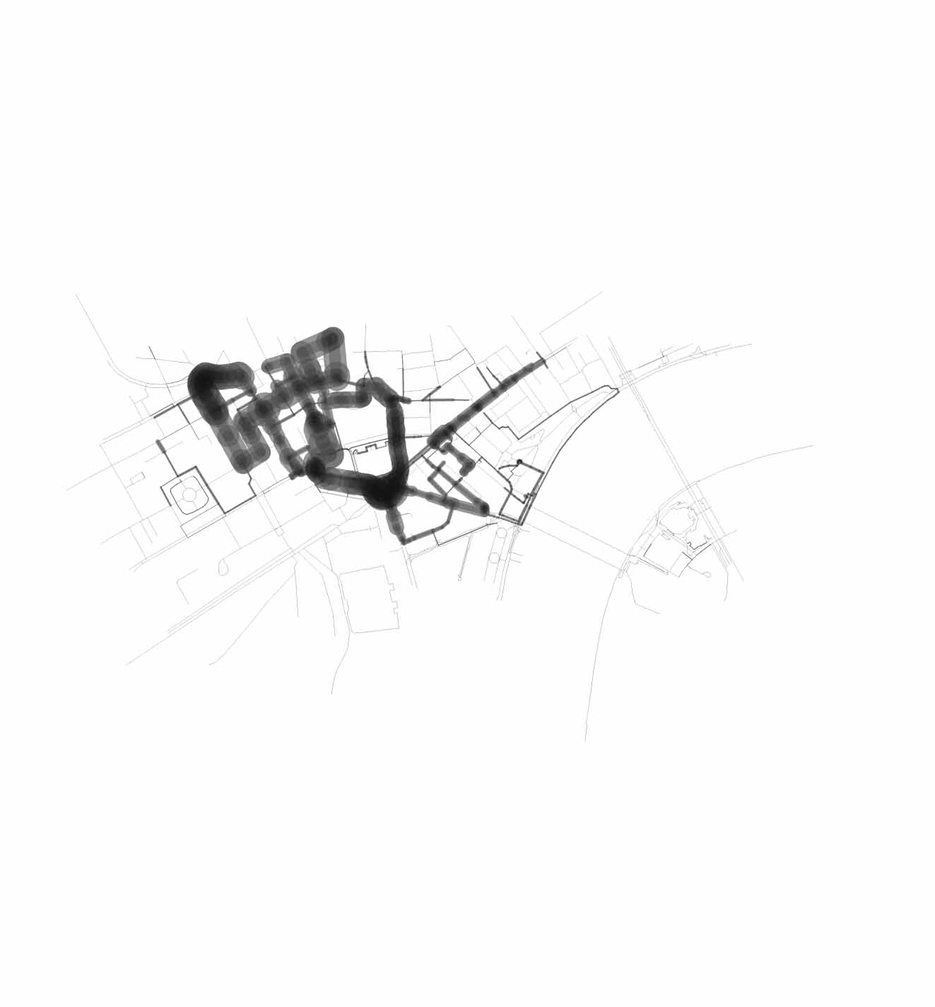
Estimated lively streets