Refugee Camp Street Networks #2: Order


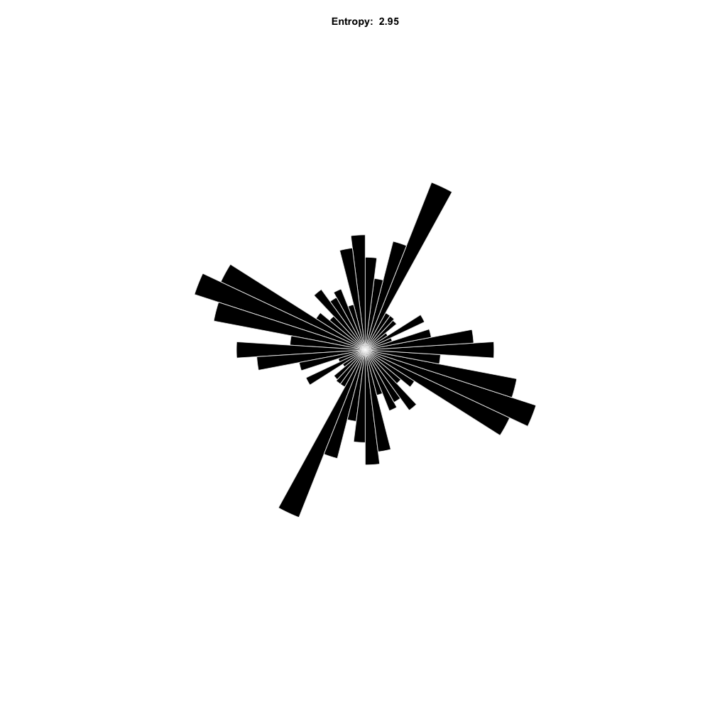
I have been looking at the street networks of 7 refugee camps around the world recently. As always with cities, it is impossible to do justice to the complexity of the situation, but no reason not to start somewhere. This analysis is inspired by the paper "Entropy and order in urban street networks" by Agust Gudmundsson and Nahid Mohajeri. Looking at the distribution of the street segments' angles gives an indication of how ordered the networks are.
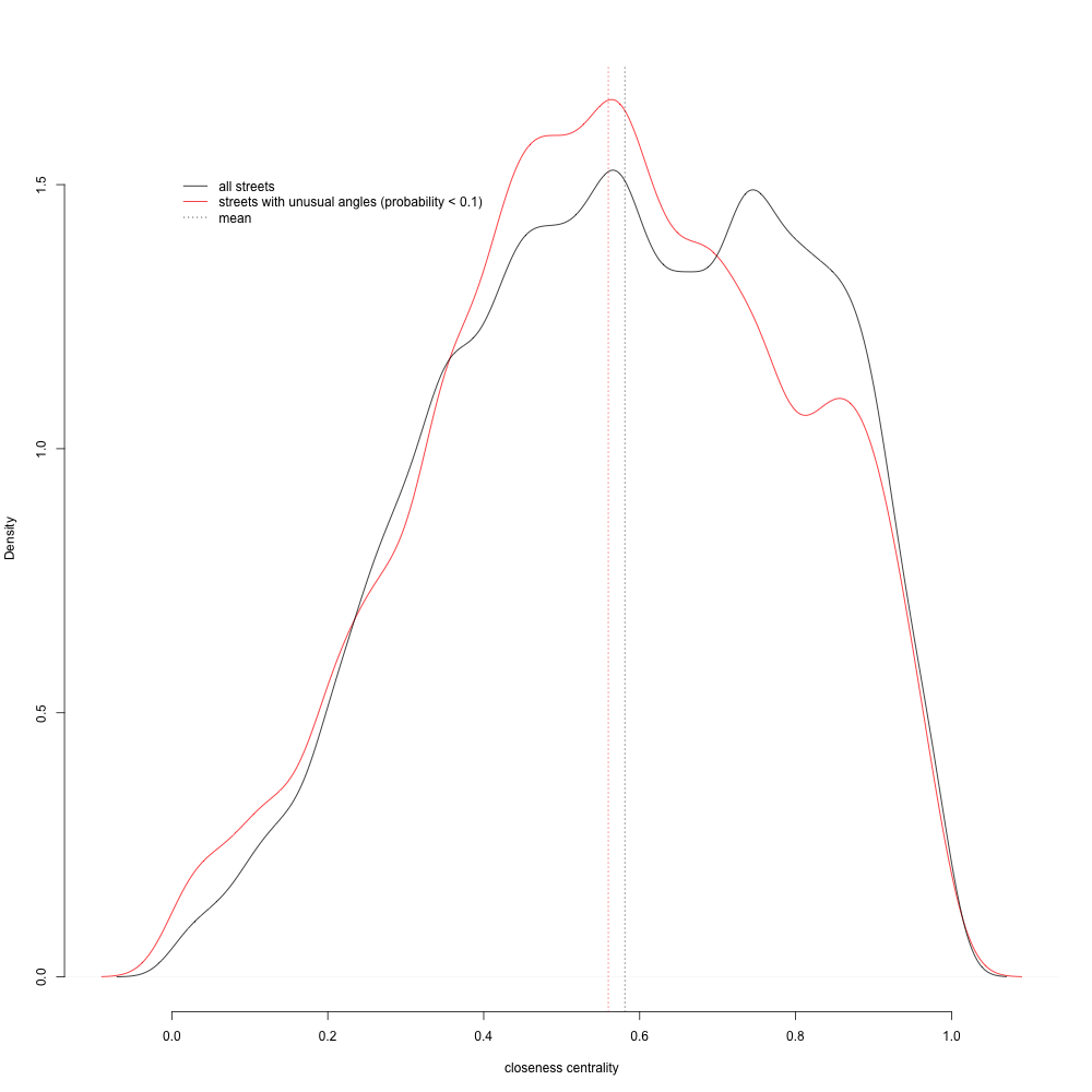
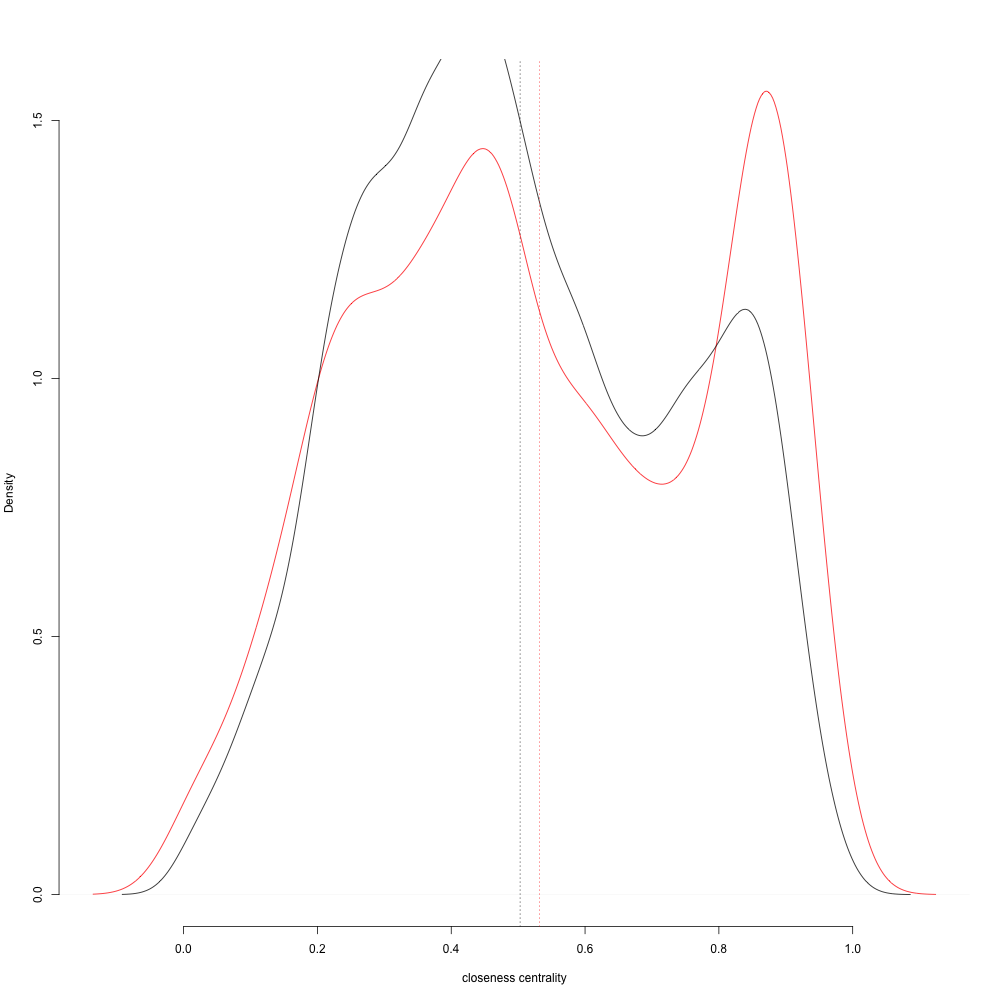
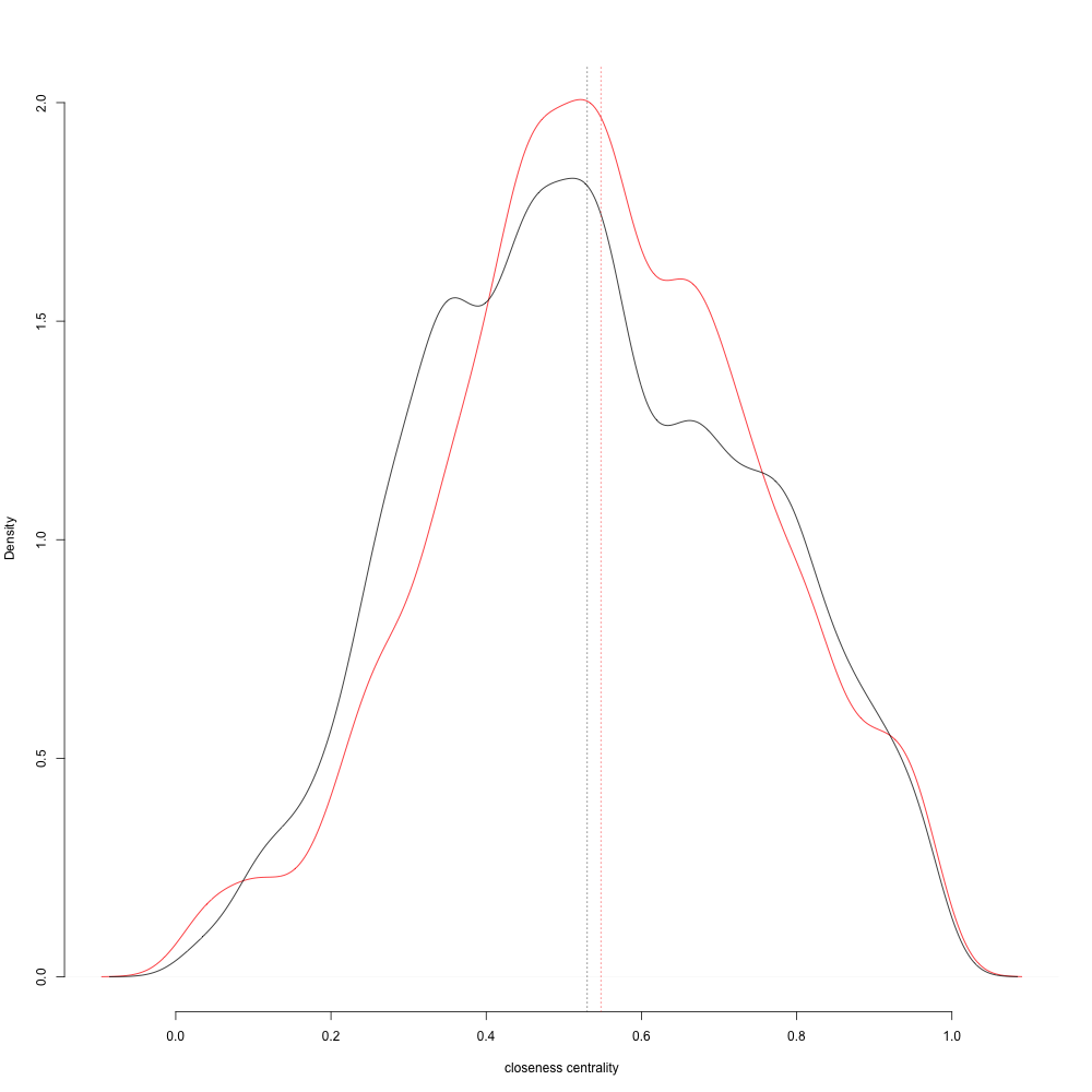
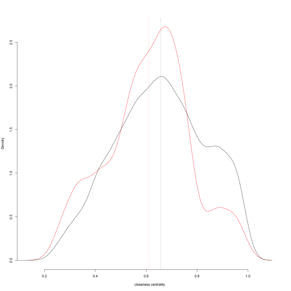
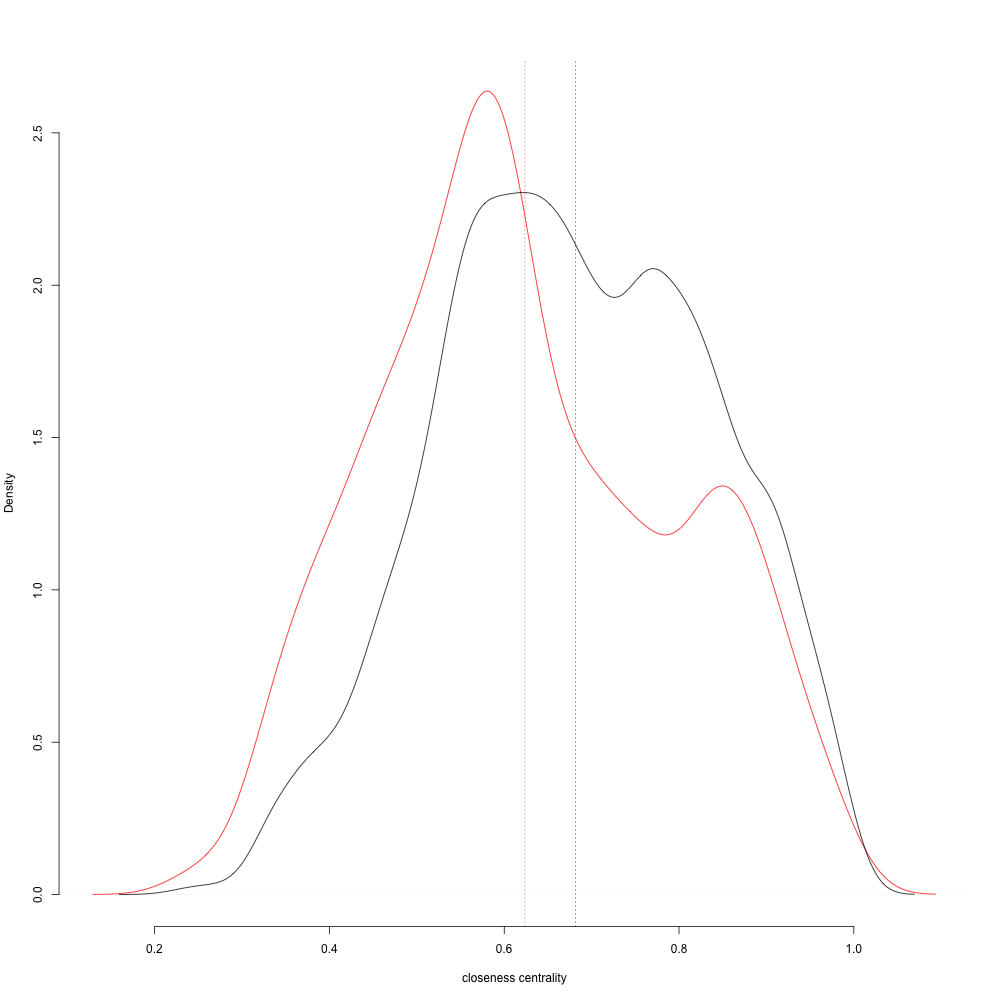
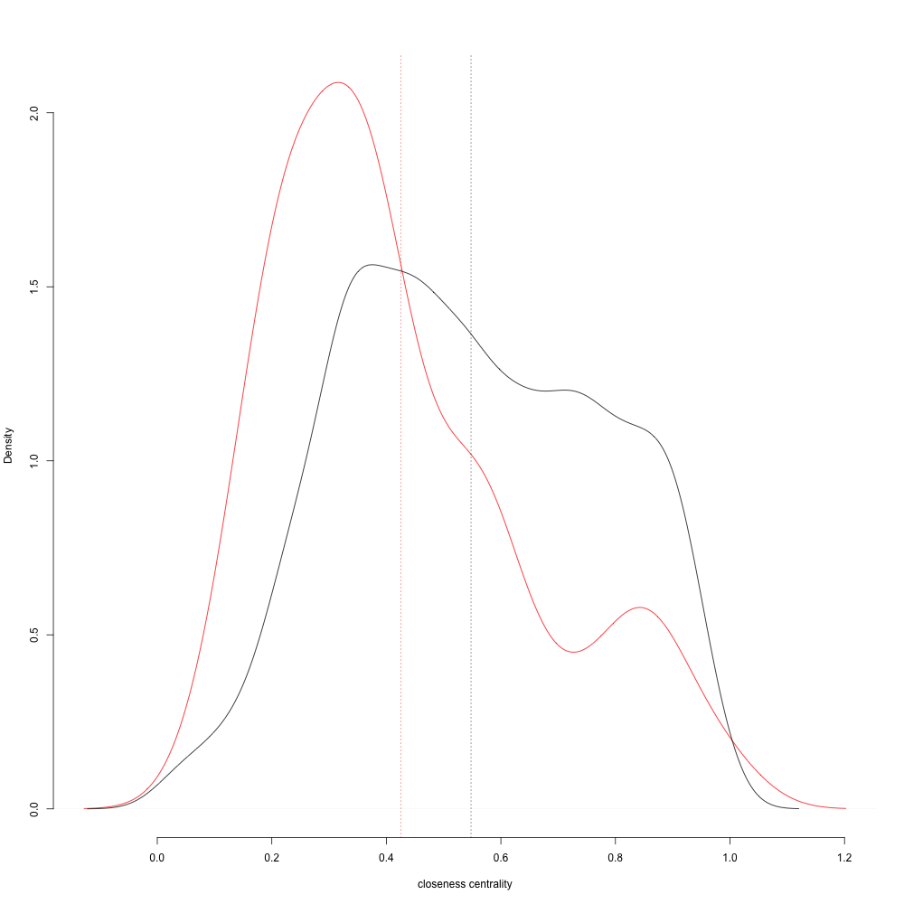
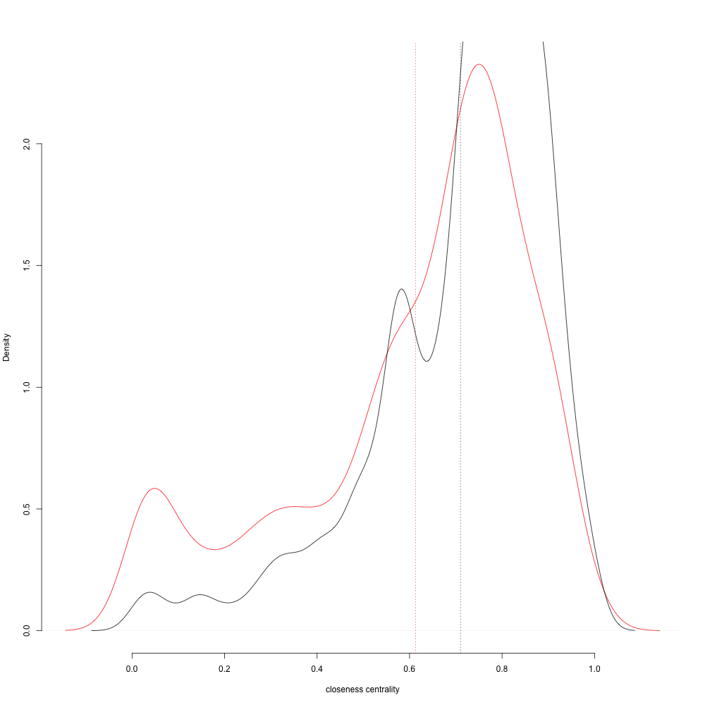
I compared the closeness centrality distribution of all street segments to the the closeness centrality of street segments with uncommon angles. I expected the camps to have a more strict grid in the center, with less orderly streets "growing" on the edges, because talk by Werner Schellenberg (the talk is in German) pointed out how camps rapidly grow beyond their intended size. The analysis shows that this is not the case! Taking into account all camps at once, the mean closeness distribution of irregular street segments does not differ significantly from the total mean. If we assume that streets that strictly follow a grid are the more formally planned parts, we see that irregular streets grow not only "outward", but equally grow "inward", building links close to the center of the networks! This is partly consistent with what we could expect in regular cities with expansion and densification.
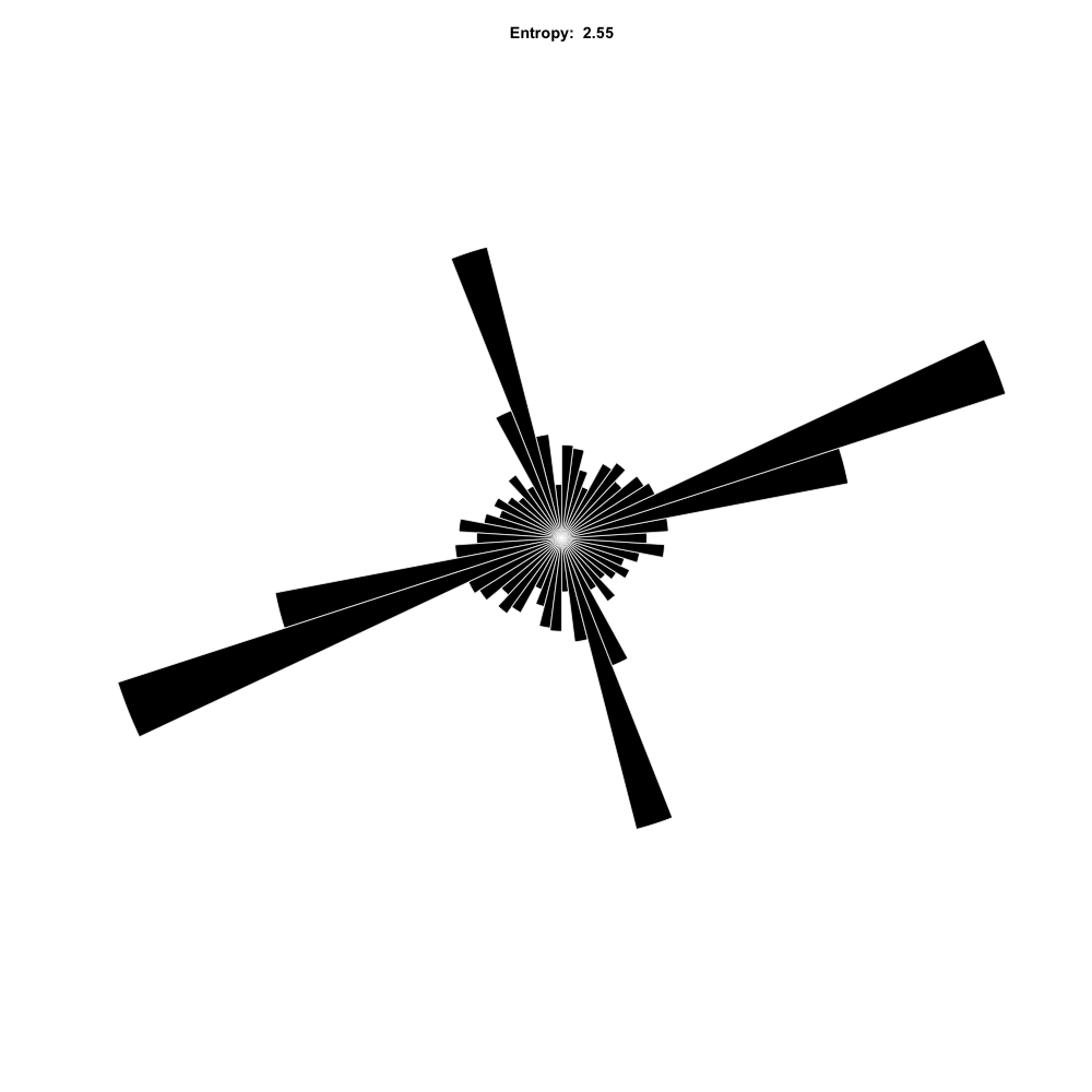
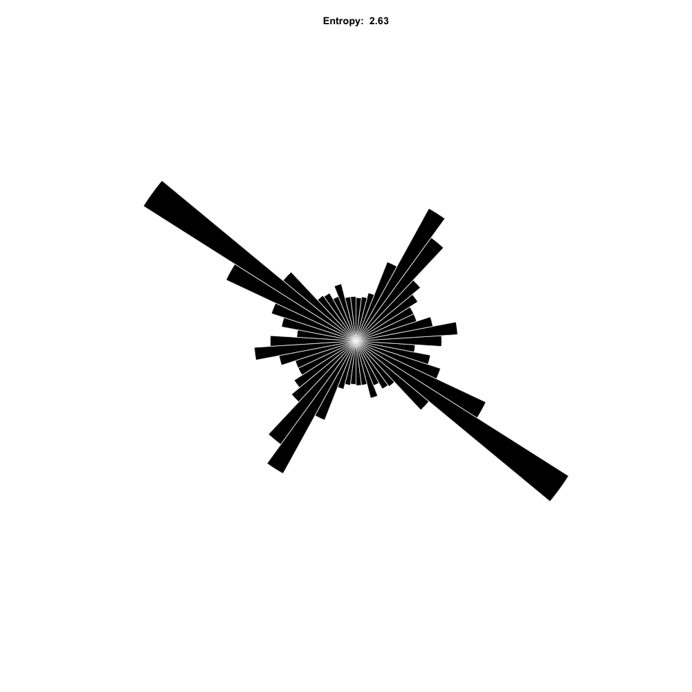
street angle entropy
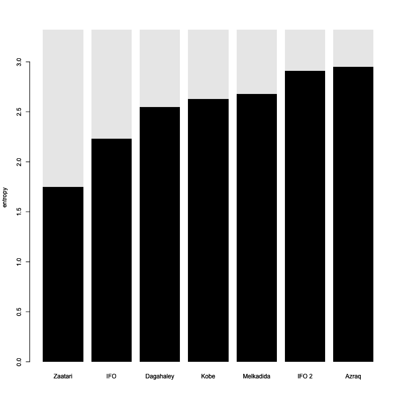
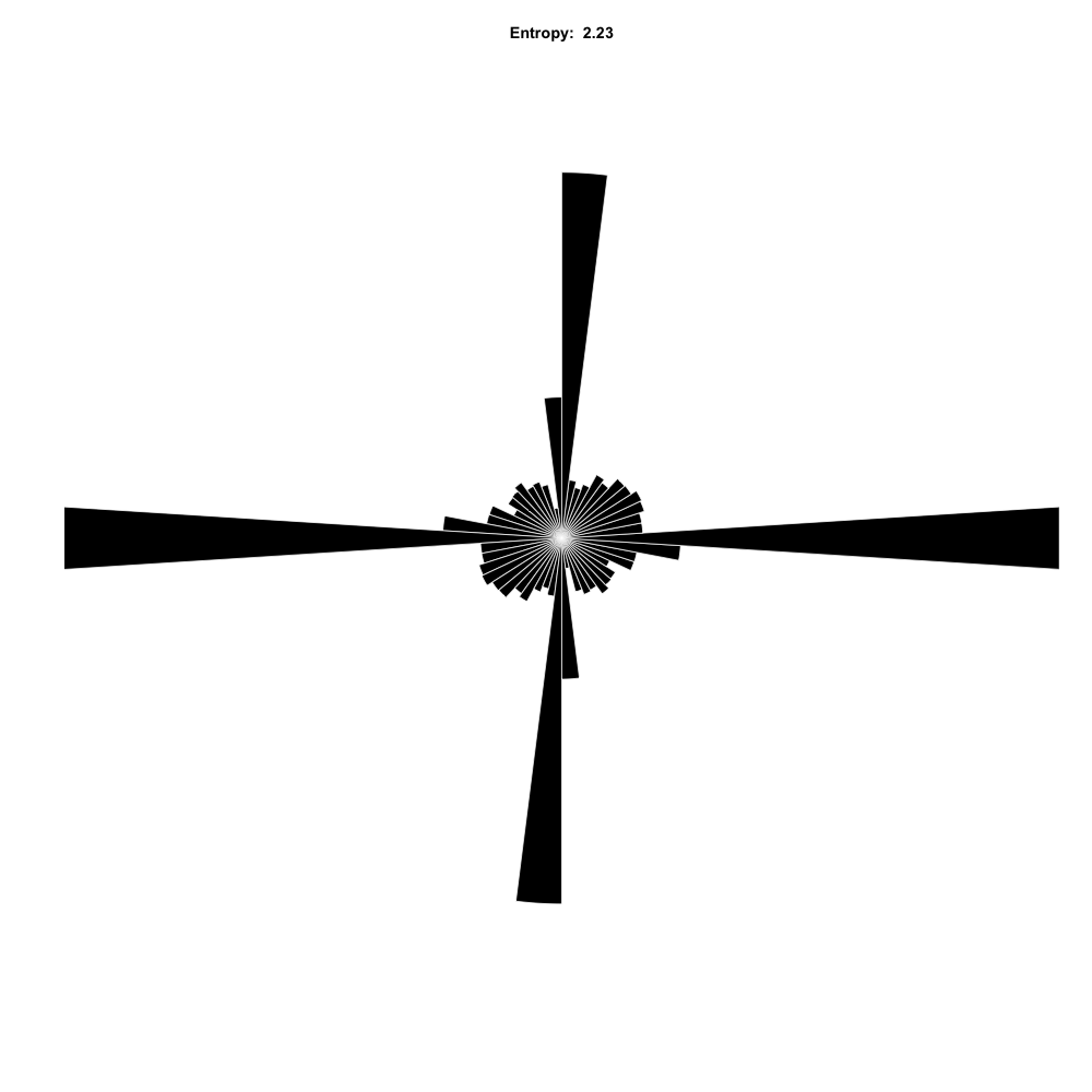
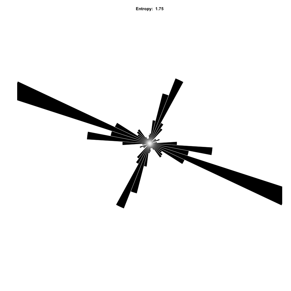
Zaatari has the lowest entropy in the distribution of angles; most of the streets are in a perpendicular grid. It has an unusually regular and compact network, except for the north-western part which has its own angle, but is more or less regular in itself. The result is a distinct angle distribution with three peaks. The camp's surrounding ringroad falls out of the grid which makes the mean closeness lower than the total mean. The north-western part looks like it was added in a less organised way, but according to Werner Schellenberg it was in fact build first. Al-Azraq is about 50km apart from Zaatari and has the highest angular entropy, mainly because of its separation in villages with different orientation.
The second highest and second lowest entropy are from IFO 2 and IFO respectively, camps that lie next to each other as well. There is no correlation between camp size and entropy.
IFO 2 is separated in two strictly regular parts connected by irregular segments, placing the irregular segments near the network's center.
In comparison to the UK cities studied by Gudmundsson and Nahid Mohajeri, entropy is very low in the refugee camps. Interestingly, refugee camps could be considered "young" cities, and the evolution over time in the city of Dundee presented in the study also shows very low entropy in the early stages of the city.
limitations
Please note that the numbers are not reliably comparable to Gudmundsson and Mohajeri's study because of slight differences in methodology. Bias also might occur because the refugee camps are smaller than the cities in the study. The referred study does not consider network centrality.
The data used here is from open street maps and therefore not evenly detailed and generally unreliable.
Most importantly, we observe only 7 refugee camps with very different structures, so the sample is far too small to make any generalisations.
See also Centrality Measures using the same data. If you have ideas, better knowledge, want more info, code or data? send me an email!
.
The second highest and second lowest entropy are from IFO 2 and IFO respectively, camps that lie next to each other as well. There is no correlation between camp size and entropy.
IFO 2 is separated in two strictly regular parts connected by irregular segments, placing the irregular segments near the network's center.
In comparison to the UK cities studied by Gudmundsson and Nahid Mohajeri, entropy is very low in the refugee camps. Interestingly, refugee camps could be considered "young" cities, and the evolution over time in the city of Dundee presented in the study also shows very low entropy in the early stages of the city.
limitations
Please note that the numbers are not reliably comparable to Gudmundsson and Mohajeri's study because of slight differences in methodology. Bias also might occur because the refugee camps are smaller than the cities in the study. The referred study does not consider network centrality.
The data used here is from open street maps and therefore not evenly detailed and generally unreliable.
Most importantly, we observe only 7 refugee camps with very different structures, so the sample is far too small to make any generalisations.
See also Centrality Measures using the same data. If you have ideas, better knowledge, want more info, code or data? send me an email!
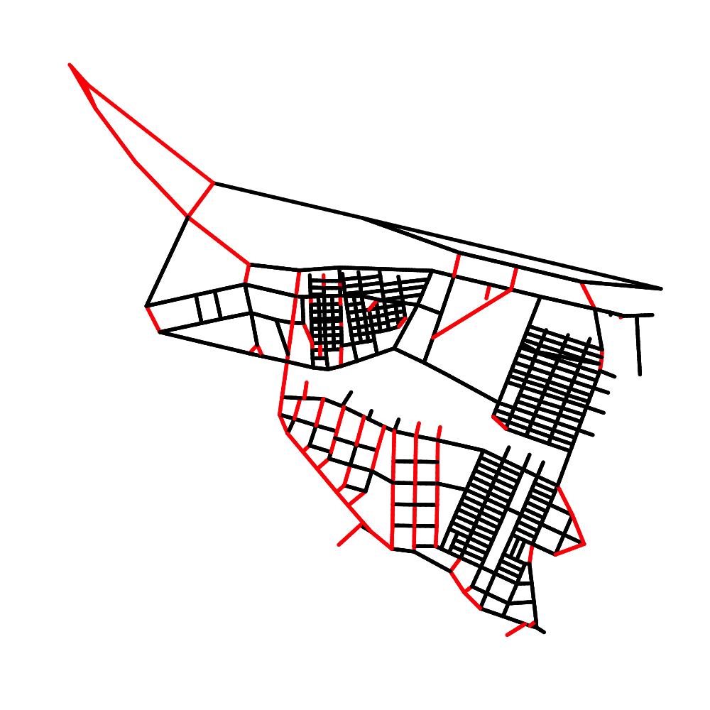
Melkadida
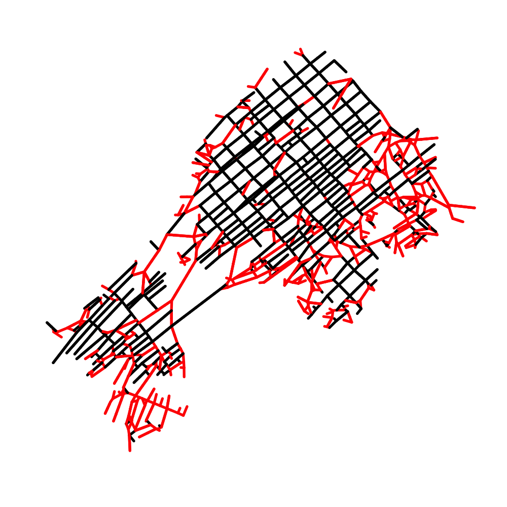
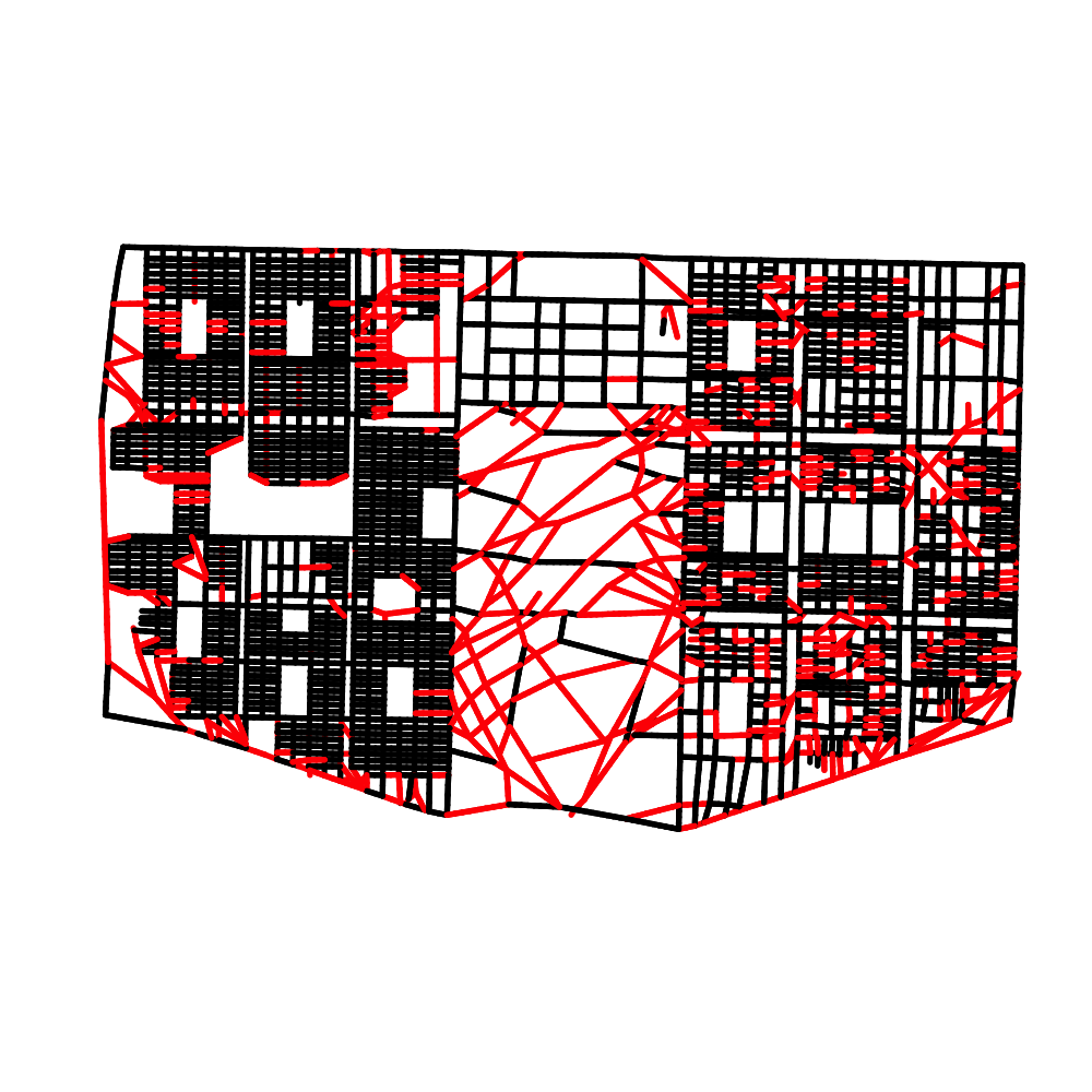
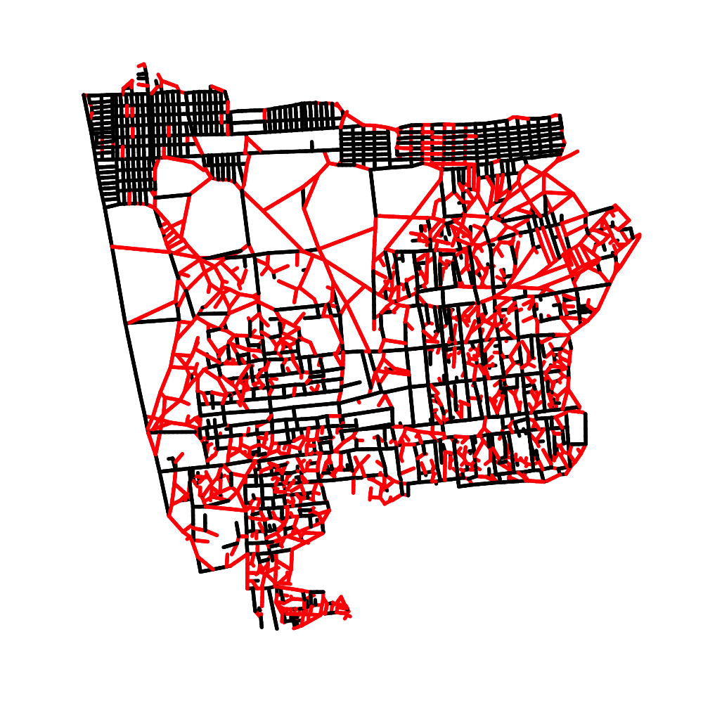
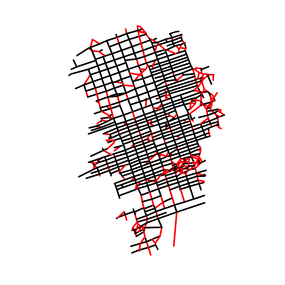
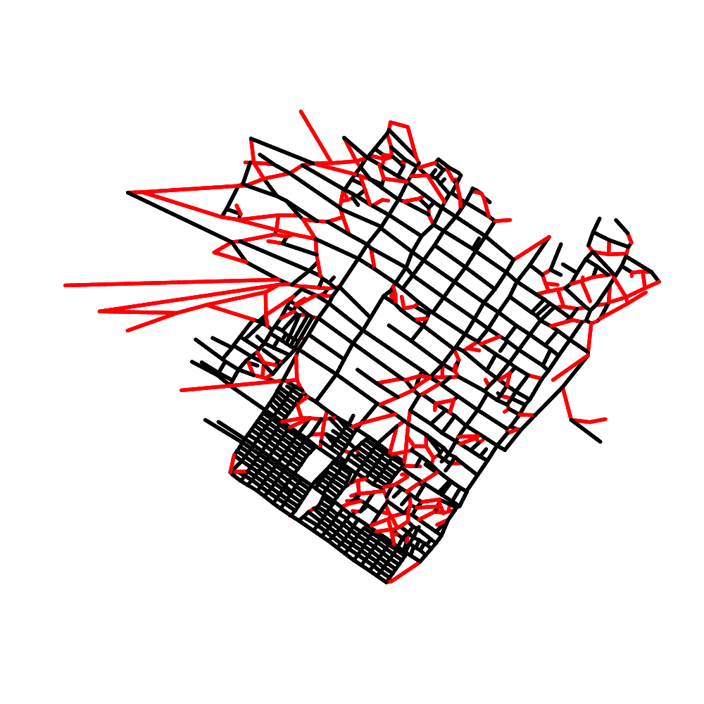
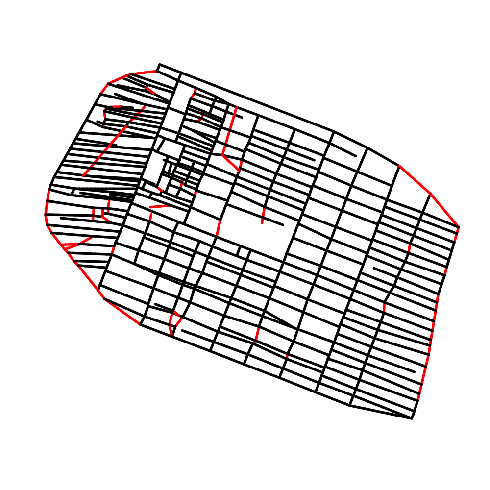
streets with angle probablity < 0.1 (10 bins) in red
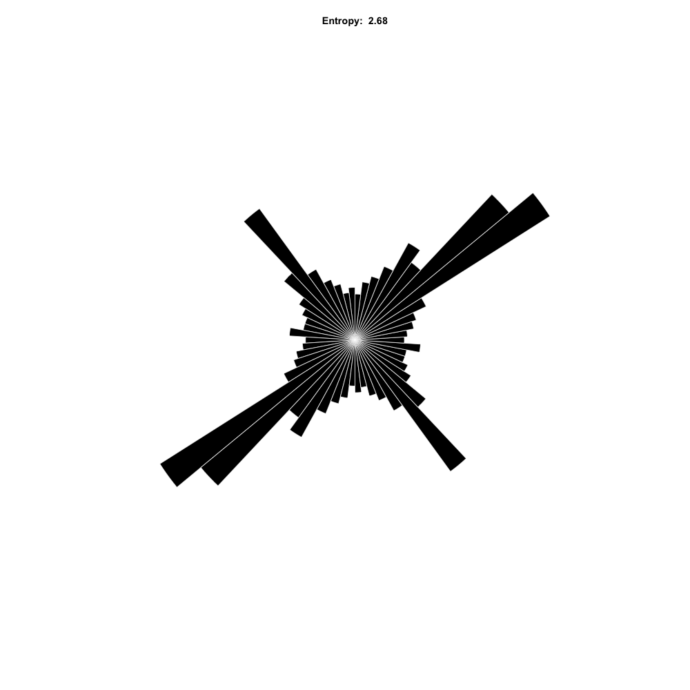
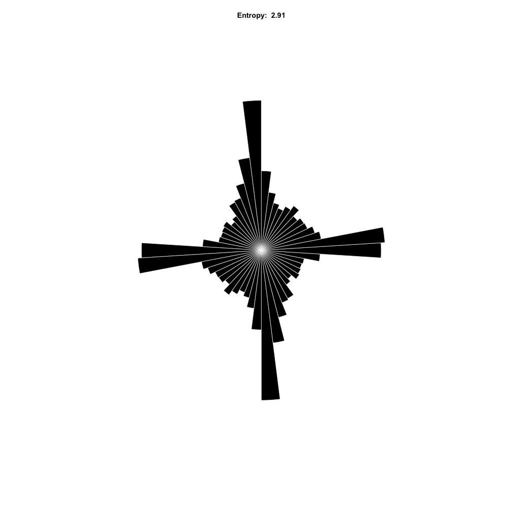
street angle distribution
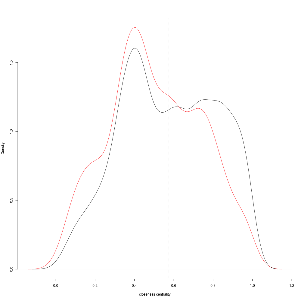
closeness centrality of street segments with unusual angles
IFO 2
streets with angle probablity < 0.1 (10 bins) in red
street angle distribution
closeness centrality of street segments with unusual angles
IFO
streets with angle probablity < 0.1 (10 bins) in red
street angle distribution
closeness centrality of street segments with unusual angles
Kobe
streets with angle probablity < 0.1 (10 bins) in red
street angle distribution
closeness centrality of street segments with unusual angles
Dagahaley
streets with angle probablity < 0.1 (10 bins) in red
street angle distribution
closeness centrality of street segments with unusual angles
Zaatari
streets with angle probablity < 0.1 (10 bins) in red
street angle distribution
closeness centrality of street segments with unusual angles
Azraq
streets with angle probablity < 0.1 (10 bins) in red
street angle distribution
closeness centrality of street segments with unusual angles